TRAIL RESOURCES
Get Directions
Filter Trails
Accessibility
The terrain at Bernheim is varied – from smooth paved walkways and boardwalks to natural, sloping trails and paths of gravel and mulch. We’ve made getting around as safe as possible and are always willing to help ensure your visit is as comfortable as we can offer.
Accessibility
Bernheim Trails
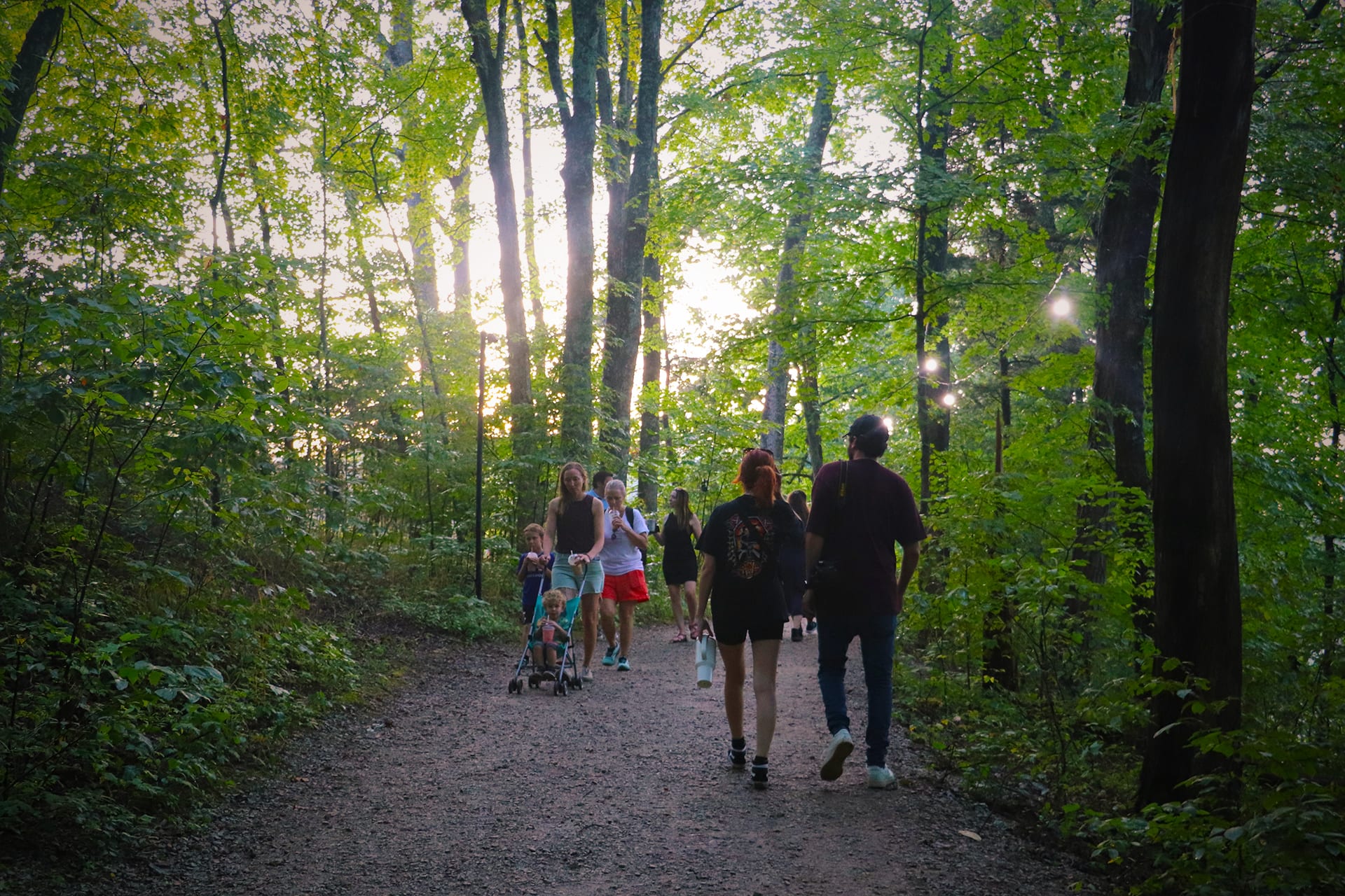
With over 40 miles of trails available, Bernheim offers diverse hiking opportunities for the curious as well as the wildly serious athlete. Enjoy the scenery as you loop through knobs and valleys and along ridges and hollows.
View trail locations on our interactive map and find out more information with the trail descriptions below.
Trail Map:
List of Trails:
Arboretum Loop (1.5 mi)

- length
- 1 to 2 miles
- walk-time
- 45 minutes
- difficulty
- Easy
Hikers are encouraged to use the hike/bike lane of Bernheim’s main road through the arboretum. This loop provides views of Bernheim’s topography and landscape features, including the grassland prairie, and highlights Bernheim’s many tree collections, including crabapples, dogwoods, magnolias, conifers and more Kentucky native trees. This trail is handicap accessible.
Bent Twig Trail (0.5 mi)

- length
- < 1 mile
- walk-time
- 15 mins
- difficulty
- Easy
This trail traverses a natural pine and cedar forest fragment, which contains a variety of vines and shrubbery undergrowth that provides a habitat for wildlife, Bent Twig Trail is short in distance with moderate changes in elevation.
Big Prairie Overlook Path (0.25 mi)

- length
- < 1 mile
- walk-time
- 5 minutes
- difficulty
- Accessible
- difficulty
- Easy
This paved pathway that takes you to the “Let There Be Light” statue marking Bernheim founder, Isaac W. Bernheim’s gravesite is lined with colorful flowers and shrubs. The top of the path provides sweeping views of Bernheim’s Big Prairie and surrounding landscape. This trail is handicap accessible.
Bike Hike Trail 🚲 (4 mi) – Temporarily Closed

- length
- 2 to 5 miles
- walk-time
- 3 hours round trip (out and back)
- difficulty
- Moderate
This out and back trail follows the course of Long Lick Creek via a paved and gravel trail. It passes through the old Clermont quarry, a section of Old Highway 245, and ends near the Bullitt/Nelson County Line. This trail is handicap accessible. Access from Happy Hollow Road, located across Highway 245 just east of Bernheim’s main entrance.
Cull Hollow Loop (1.5 mi)

- walk-time
- 1 hour
- length
- 1 to 2 miles
- difficulty
- Moderate
Cull Hollow Loop is a trail with varying elevations, winding through many ridges and mounds of unknown origin (archaeologists have failed to find anything of note). Along the trail you will see the effects of logging and iron ore mining in the region.
Elm Lick Trail (5 mi)
- length
- 2 to 5 miles
- walk-time
- 2-3 hours
- difficulty
- Difficult
The Elm Lick Trail takes you on a journey across the Elm Lick Watershed through many types of landscapes. This difficult trail has several steep sections and stream crossings and weaves through grasslands, valleys, oak-hickory and beech-maple forests, and an old homesite.
Fire Tower Loop (0.5 mi)

- length
- < 1 mile
- walk-time
- 20 minutes
- difficulty
- Moderate
This trail will take you to the site of Bernheim’s historic fire tower, which was built in 1929. The fire tower is open to the public based on staff/volunteer availability. This trail has steep sections to traverse en route to the fire tower.
Forest Giants Trail (2 mi)

- length
- 1 to 2 miles
- walk-time
- 1.5 hours
- difficulty
- Easy
The Forest Giants trail is an out and back trail, one mile each way. It leads from the Visitor Center to see all three of the Forest Giants in a Giant Forest. The first section is flat and mostly paved following along the Olmsted Ponds. The trail then crosses the Big Prairie – a prime spot to see native grasses and other prairie habitat. The final section of the trail is across rougher terrain, winding through parts of our popular Sun and Shade Loop to Lake Nevin, where you’ll see some of our renowned plant collections, including magnolias and the cypress tupelo swamp. Visitors with strollers and other accessibility challenges should allow extra time. Parking is available closer to each of the Giants for those who do not want to hike the full trail. Parts of this trail are exposed to full sunlight, so don’t forget your water and sunscreen on sunny and warm days.
Guerilla Hollow Loop (1.2 mi)

- length
- 1 to 2 miles
- walk-time
- 45 minutes
- difficulty
- Moderate
Guerilla Hollow got its name as a result of guerilla activity during the Civil War. Though not still apparent, the trail passes through old homesteads. This trail weaves through some of Bernheim’s most mature wooded areas, with some moderate and steep slopes.
High Point Loop (0.5 mi)
- length
- < 1 mile
- walk-time
- 15 minutes
- difficulty
- Easy
High Point Loop crosses Bernheim’s highest elevation of 927 feet. Don’t expect panoramic views though; this trail winds through intermittent streams throughout a beech and maple woodland with only some gentle slopes.
Iron Ore Hill Loop (1.5 mi)
- walk-time
- 1 hour
- length
- 1 to 2 miles
- difficulty
- Moderate
Iron Ore Hill derives its name from the iron industry that flourished in the area in the mid 1800s. This trail with moderate to steep slopes overlooks a valley, and weaves through a forest that has been cut down many times in its history. This trail will give you access to the Canopy Tree Walk, a must-see at Bernheim.
Jackson-Yoe Loop (2 mi)
- walk-time
- 1 hour
- length
- 1 to 2 miles
- difficulty
- Difficult
Jackson-Yoe loop crosses diverse lowland and upland terrain, within a oak-hickory forest. Named for two families that lived in the area in the 1800’s, the trail includes the Jackson family cemetery. This difficult trail has some steep sections and can get slippery in wet conditions.
Knob Top Trail (.5 mi)
- length
- < 1 mile
- walk-time
- 30 minutes
- difficulty
- Difficult
Knob Top trail serves as a connector between Lake Nevin Loop and Two Ponds Loop, and provides access to Bernheim’s crabapple and maple collections. This hike to the top of Inspiration Knob provides a panoramic view of Lake Nevin. The trail features a gradual climb with some obstacles.
Lake Nevin Loop* (1.3 mi)
- walk-time
- 1 hour
- length
- 1 to 2 miles
- difficulty
- Easy
This trail circles the 32-acre manmade Lake Nevin, a feature of the landscape design created by the Olmsted Brothers in 1948. This mostly flat and gravel-paved trail crosses through many of Bernheim’s beautifully landscaped gardens and connects to several other trails. This trail highlights Lake Nevin’s features, including the cypress-tupelo swamp, bluegrass savanna, and its irrigation duties for Bernheim’s arboretum. You’ll also see several of Bernheim’s collections, including trees Native to Kentucky.
Millennium Trail (13.75 mi)

- length
- 5+ miles
- walk-time
- 6-7 hours
- difficulty
- Difficult
Please register at the Visitor Center or the trail head upon beginning the Millennium Trail. The Halfway point of the trail is located off Paul’s Point Loop (see map).
The Millennium Trail is Bernheim’s longest trail and is recommended for experienced hikers only. It winds through ridges of oak-hickory forests to valleys and streams of beech-maple forests. This difficult trail features several steep slopes, creek and road crossings, and rough terrain.
Due to early closing times in the winter, all hikers should begin the Millennium Trail prior to 9:00 a.m. November – March.
Nursery Loop* (1 mi)

- length
- 1 to 2 miles
- walk-time
- 40 minutes
- difficulty
- Easy
This loop provides access to Bernheim’s Edible Garden and Research Building. Views into the plant nursery provide you with a behind the scenes glance into Bernheim’s horticultural work. Nursery loop features many wildflowers and moss and is a good place for bird viewing. The trail is mostly paved or gravel with only small slopes.
Overalls Loop (0.25 mi)
- length
- < 1 mile
- walk-time
- 10 minutes
- difficulty
- Easy
This flat and easy trail connects to one of Bernheim’s fire roads. This upland trail winds through a primarily oak-hickory forest.
Rock Run Loop (0.5 mi)
- length
- < 1 mile
- walk-time
- 30 minutes
- difficulty
- Moderate
This trail is a visitor favorite. Traversing slopes along Rock Run Creek, Rock Run Loop provides a great opportunity to view limestone and shale outcroppings, and is excellent for viewing wildflowers. The trail includes a creek crossing as well as several steep sections and obstacles.
Seasonal Prairie Trails (1-2 mi)
- length
- 1 to 2 miles
- walk-time
- 1-2 hours
- difficulty
- Easy
The mowed pathways through the grassland prairie provide easy walking with mostly even terrain, though caution of uneven terrain is encouraged. Use Big Prairie trails to connect to other trails in the Arboretum.
Sun and Shade Loop* (0.75 mi)
- length
- < 1 mile
- walk-time
- 40 minutes
- difficulty
- Easy
This trail journeys through Bernheim’s mature forested area as well as collections of understory woody plants that are suitable for home landscapes. Part of this trail winds through natural forested area with bridged stream crossings, part through gravel paths in the open landscape.
The Meditation Trail (0.5 mi)
- length
- < 1 mile
- walk-time
- 15 minutes
- difficulty
- Easy
The Meditation Trail, in honor and memory of Lily Banerjee, is an invitation for visitors to commune with nature in their own personal way. It’s sited along Bernheim’s beloved Bent Twig trail and consists of six spurs, each with its own meditation prompt based on a positive attribute of a nearby tree. Signage offers engaging information about the tree itself and a meditation prompt to focus on that tree’s positive quality. Beautiful handmade wooden benches and decks offer a welcoming place to pause, contemplate, breathe, and center oneself.
Discover the Meditation Trail
Two Ponds Loop (0.7 mi)

- length
- < 1 mile
- walk-time
- 30 minutes
- difficulty
- Moderate
Two Ponds Loop provides an overview of Bernheim’s horticultural sciences, native habitat displays, and the arts, weaving through the Big Prairie and the world renowned Holly Collection along its route. Works of art and sweeping views highlight this trail. It is mostly flat, but does go through some gentle hills and rocky terrain.
* Partially accessible trail. Please ask the Visitor Center for details.
🚲 Biking is welcome on any of Bernheim’s paved roads that can be accessed from within Bernheim’s main roads.